URPoint Details
A hamlet with some thatched cottages, a church with a ruined tower and acres of meadow and woodland, drained by the Blackwater river – where, a few miles downstream becomes the river Yare.
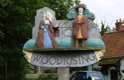
Before 1066 the land was owned by a Saxon gentlewoman named Alfeva or Aelgifu, who also had property at Grimston, Feltwell, Hockwold and Witton. At the Conquest, Alfeva was expelled and the estate passed to William, Earl of Warenne. The family took the name of de Rising and held the estate until 1370.
A later lord of the manor, John Weyland (d 1767), built the great vaulted barn at Church Farm. The Weyland family were probably the builders of most of the existing buildings in the parish.
- Type:
- Landmark


