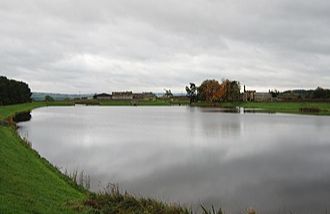
Whittle Dene Reservoir Claimed
URPoint Details
Hadrian’s Wall Trail can be uneven and cause problems for people with specialised access requirements. The bird hide is accessed via a set of steps. Please note that most of the reserve has no public access.
Whittle Dene is 12 miles (19 km) west of Newcastle upon Tyne, straddling the B6318 Military Road, and is a complex of reservoirs and treatment works forming the last stage in the supply of drinking water to Newcastle upon Tyne and Gateshead. The complex forms part of a series of reservoirs along the A68 which are connected by tunnels and aqueducts from Catcleugh Reservoir to Whittle Dene The reservoirs that form the chain are, from northwest to southeast: Catcleugh Reservoir → Colt Crag Reservoir → Little Swinburne Reservoir → Hallington Reservoirs → Whittle Dene. There are a huge variety of habitats including conifer and mixed plantations, neutral grassland and marshy grassland. The whole complex is designated as a Local Wildlife Site due to its importance for wildlife. By the end of March, the first sand martins can usually be seen over the reservoirs and summer visitors continue to increase throughout April and May when large numbers of swallows and swifts
- Type:
- Landmark


