URPoint Details
The village is recorded in the Domesday Book, but evidence shows that there was a settlement here before that. It was recorded as being one and a half leagues long and half a league wide. The Domesday Book also records that a church endowed with 40 acres of glebe land.
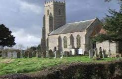
The earliest surviving of the church is the late 13th century chancel. The position of this little attractive church and it is most unusual for the main entrance to a church to be on the north side.
Much of the boundary between Hapton and Tharston is defined by a branch of the river Tas.
A feature of the Tharston landscape is the number of ‘hollow ways or lanes which run in deep cuttings between high banks. These lanes often mark the ancient boundaries between the enclosed land belonging to the manor or rectory and the open fields and lands held in common by the villagers and smaller farmers.
- Type:
- Landmark


