URPoint Details
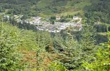
A village in the Strath of the Strathyre through which flows the River Balraig.
The Strathyre Forest established in the 1930s, the entire valley is clad in pine trees.
The village is noted as a summer resort for walks in the surrounding hills and lies in the heart of the country described by Scott in his ‘Lady of the Lake’ and ‘Legend of Montrose’.
The Balvaig Burn flows through the village and is crossed by an old bridge.
To the south in a setting of hills is the narrow Loch Lubnaig noted for its fishing its wooded eastern shore crossed by the road leading southwards towards the Pass of Leny with its falls to reach Callander.
To the southwest is Ben Vane at 2,685ft and to the east rises Stuc a’Chroin to 3,189ft and Ben Vorlich at 3,224ft.
At the southern end of the loch is the tiny churchyard on the site of St Bride’s Chapel and across the water is Ben Ledi at 2,875ft.
- Type:
- Landmark


