URPoint Details
A little clachan where an inn was formerly situated at the head of Loch Inchard on the northern edge of the huge Reay Forest, once the hunting grounds of the chiefs of the Clan MacKay an area for deer.
Foinaven rises to 2,980ft and dominates the range with the rocky Creag Dionard overlooking the bleak head of Strath Dionard and its lovely loch farther to the southeast.
To the south rises Arkle at 2,580ft with its rough scree slops backed by the peak of Meall Horn at 2,548ft.
The whole area around Rhiconich has numerous lochans lying among outcrops of Archaean grey gneiss, some of the world’s oldest rocks.
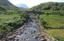
On the road to Durness the Archriesgill Water wends through a picturesque ravine.
- Type:
- Landmark


