URPoint Details
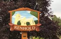
A long straggling village stretching down to the River Ouse in attractive countryside once belonged to the Polhill estate and in 1919 land was sold off to farmers and other villagers.
The Danes occupied this part of the county at one period.
All Saints Church stands high among the trees at the east end of the village, surrounded by a neat well kept churchyard. It has a robed choir of 24 and a happy band of campanologists. The Norman font, is drum-shaped and has unfinished carvings on an ornamental band. The pulpit, with detailed panels dates from the 17th century.
- Type:
- Landmark


