URPoint Details
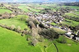
The ruins of a castle date New Radnor back nine centuries and sits at the base of ‘The Smatcher’ at 1,396ft in the Radnor Forest. On the other side of the forest is a waterfall known as ‘Water breaks its neck’.
The town lies in a pleasant valley of the River Somergill and is surrounded by wild hills.
The Church of St Mary, standing on a hill is the restored Norman church dating from 1840.
- Type:
- Landmark


