URPoint Details
Gaelic: LochTeimhil
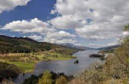
A long, narrow loch, 7 kilometres northwest of Pitlochry,and is approximately 11 kilometres long from east to west, and just under 1kilometre wide.
It became part of the Tummel Hydro-Electric Power Scheme when the Clunie Dam was constructed by Wimpey Construction at its eastern end in 1950 raising the water level by 4.5 metres.
The loch is traversed by roads on both north and south banks, offering splendid views of the surrounding countryside.
The best is probably the well-known 'Queen's View' from the north shore, which Queen Victoria made famous in 1866, offering a magnificent vista over the loch with Schiehallion in the background. It is also claimed that the view was originally named after Queen Isabel wife of Robert the Bruce.
Above the head of the loch, Tummel Bridge crossing the River Tummel actually has two bridges. The original bridge built by General Wade in 1730 has a modern replacement alongside carrying the traffic from Aberfeldy.
At the eastern end, high in Glen Fincastle to the north, sits Fincastle House, a 17th-century seat of a branch of the Stewarts with links to the 1745 rebellion.
At the head of the glen are the standing stones
- Type:
- Landmark


