URPoint Details
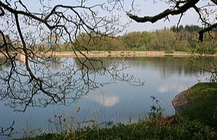
Leigh Reservoir is an artificial lake in the parish of Pitminster, some 15.1 kilometres (9.4 mi) from the sea. It is to the west of Luxhay Reservoir and south of the village of Lowton, near to Angersleigh It is 160 metres (520 ft) above sea level. The reservoir is near the southern boundary of the River Tone catchment basin. A plaque on the reservoir is dated 1893, and gives the surface area of water as 6 acres (2.4 ha) and greatest depth 38 feet (12 m). It was to contain 26,000,000 imperial gallons (120,000,000 l; 31,000,000 US gal). The reservoir today has an average depth of 1.33 metres (4 ft 4 in) and a surface area of 2.128 hectares (5.26 acres), with a catchment area of 20.5 hectares (51 acres). The perimeter is 0.6 kilometres (0.37 mi).
- Type:
- Landmark


