URPoint Details
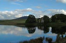
Harperrig Reservoir is a reservoir to the west of the Pentland Hills, four miles south of Mid Calder. The Water of Leith flows through it, and nearby are Eliburn and Cobbinshaw Reservoirs.
- Type:
- Landmark

Harperrig Reservoir is a reservoir to the west of the Pentland Hills, four miles south of Mid Calder. The Water of Leith flows through it, and nearby are Eliburn and Cobbinshaw Reservoirs.