URPoint Details
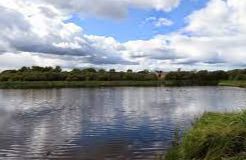
A small shallow loch in the northeast of Glasgow, on the boundary of North Lanarkshire.
Frankfield Loch occupies a kettle-hole of glacial origin, a quarter-mile (0.4 km) south of Stepps and a mile (1.5 km) east northeast of Hogganfield Loch
Frankfield Loch is the source of the Molendinar Burn which flows into the latter. Both lochs once supplied water to nearby mills.
- Type:
- Landmark


