URPoint Details
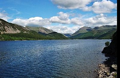
Ennerdale Water is the most westerly lake in the Lake District National Park. A glacial lake, with a maximum depth of 150 feet (45 metres), and ½ mile to a mile (700 to 1,500 metres) wide and 2½ miles (3.9 kilometres) long. The lake lies in the valley of Ennerdale, surrounded by some of the highest and best-known fells in Cumbria including: Great Gable (899 m), Green Gable, Brandreth, High Crag, Steeple and Pillar.
To the west of the lake lies the hamlet of Ennerdale Bridge, consisting of two pubs and a few houses. It is close to the port of Whitehaven. Ennerdale Water is fed by the River Liza and other streams, and in turn feeds the River Ehen, which runs to the Irish Sea.
Ennerdale has been designated a biological Site of Special Scientific Interest (SSSI). Species of interest include the Arctic char. The site contains a variety of habitats apart from the open water of the lake itself. The shore length1: 10 km (6.2 mi) Max. length: 4.17 km (2.59 mi) Islands: 4 Max. depth: 45 m (148 ft)
Former US President Bill Clinton first proposed to his wife Hillary on the banks of Ennerdale Water in
- Type:
- Landmark


