URPoint Details
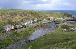
A little fishing village by the Dunbeath River where it flows into the bay. The name supposedly is derived from the broch of Dun Beath which stands in the angle formed by the river and the Burn of Houstry to the northwest of the village. The castle captured by
West of the village on the moors inland near Braemore near the Berriedale Water is a granite cross marking the place where the Duke of Kent was killed in flying accident in 1942. The coast road leading southwest from Dunbeath gives you overwhelming views of the lofty Caithness plateau.
- Type:
- Landmark


