URPoint Details
The green river valley, sheltered on three sides by gentle uplands would have been an ideal spot with a stream running through the centre (now piped underground) to settle.
The Romans were here and in 1849 when finds of pottery and a small ampulla or flask was discovered.
There are also signs that Angles, Saxons and Danes came plundering this peaceful farming community from AD450 onwards.
Legend has it that a battle was fought between Saxons and Danes on a field by the river, called Bloodsdale. Burial urns were unearthed in 1848, one containing a dagger.
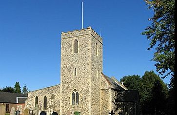
A church was built on the site of St Margaret’s during the reign of Richard I and the first appointed rector in 1198 when Hermanus de Draiton, lord of the manor, presented his son Peter to the living. However, the font is thought to date from 1150 and the graveyard from 1160.
- Type:
- Landmark


