URPoint Details
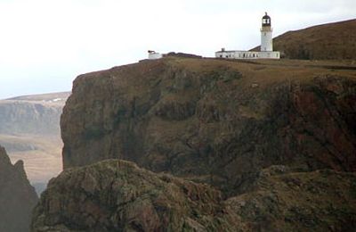
Cape Wrath Lighthouse at Cape Wrath was built in 1828 by Robert Stevenson and was manned until 1998, when it was converted to automatic operation by the Northern Lighthouse Board. It is located at the most North-Westerly point on the British mainland, in the traditional county of Sutherland within Highland Region. Durness is the closest village, 10 miles (16 km) to the south-east with Inverness around 120 miles (190 km) to the south.
Overlooking the Cape are the ruins of the Lloyd's signal station, which was used to monitor shipping and was built in the 19th century. The light, which is 122 metres (400 ft) above sea level, is visible for 22 nautical miles (41 km; 25 mi).
Due to its height the light was often obscured by low cloud or fog and in the early 20th century plans were drawn up to build an additional low light. This involved the construction of tunnels into the headland, bridges and building on the very tip of the rocks below the headland. Plans were drawn up by David Alan Stevenson. The light was originally a paraffin lamp with red and white reflectors. This was replaced by mercury vapour lamps in 1978 and in 1980 an electrical temporary power beam was installed with a
- Type:
- Landmark


